The Dirouilles are the smallest and least visited of the three reefs north of Jersey. The largest the Écréhous are 10km to its north east, the Paternosters 4km north of Sorel. The Dirouilles are 6km off Jersey’s NE corner, approximately two-thirds of the way from the Paternosters to the Écréhous.
In Jersey Place Names [1] the derivation of Dirouilles is considered very uncertain. It may mean mischievous dwarf, which could be appropriate for a reef smaller than, but neighbouring, the Écréhous.
Until last year I had only visited them en route from the Paternosters to the Écréhous. Believe me, kayaking through them in a big sea can be challenging, even frightening.
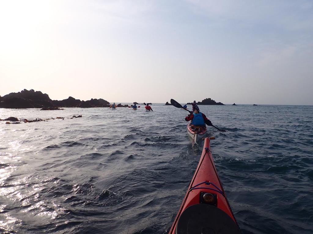
From 2019 Jersey Canoe Club has been visiting the Dirouilles more regularly, attracted by their untroubled quietude. We went there this week for the first time in 2021, a round trip of 20.8 km (11.3 nautical miles).You can land around 2 hours either side of low, but only on a calm day. You are taken there on the falling tide and back on the rising tide, so a great trip.
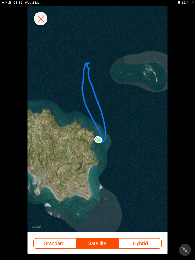
The Strava image of our track looks like we were paddling to nowhere. You can make out the Écréhous to the east, but not the Dirouilles.
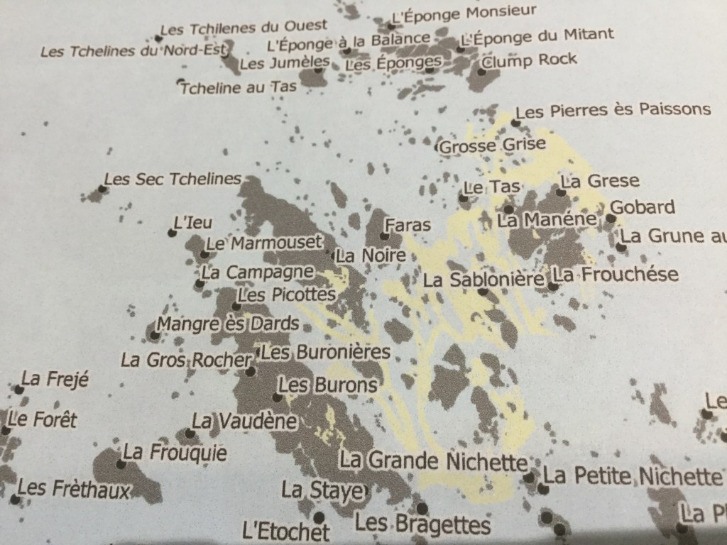
The extract frpm Paul Chambers’s wonderful “Jersey Rock and Coastal Names Project Atlas” gives a better impression of the Dirouilles, in yellow, intertidal sand or beach, in grey, rock exposed at low water, and in black rock that doesn’t cover but will be affected by spray off breaking waves.
The first two photos below were taken last summer.
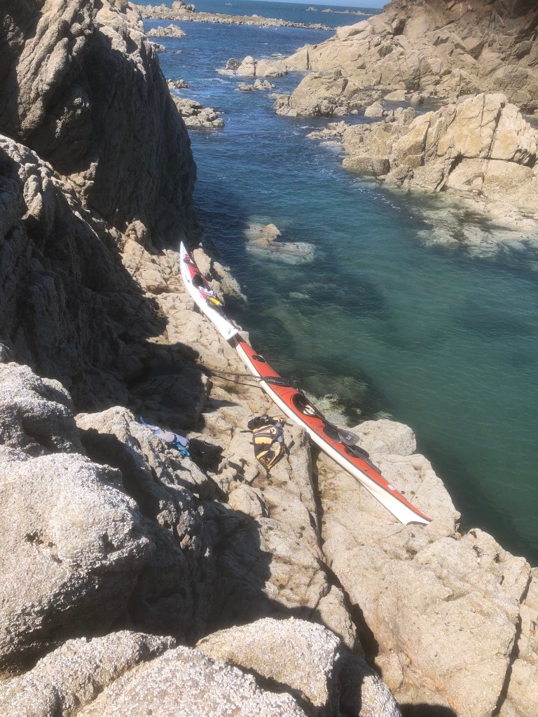
My boat and Kevin’s balanced on a shelf at La Gros Rocher

Nicky and Rachel swimming in the channel alongside La Gros Rocher
The next three photos were taken on Tuesday 2 March 2021
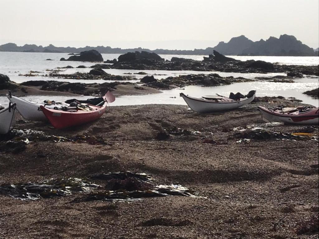
The kayaks beached on sand to the south of La Noire
Leaving the Reef

A discordant stone, one of twelve Kevin identified amongst the rocks of the intertidal zone south of La Noire.
The stone appears to have been worked. It sits on the quite different base rock, which in the Écréhous and Dirouilles is granodiorite, similar to granite but associated with the subduction zone of intrusions where the oceanic lithosphere sank back into the mantle. The discordant worked stones are diorite (?). Clearly different from the grandiorite, they stand out with seaweed clinging less to them than to wave cut base rock.
The location of the twelve discordant stones forms an approximate cross, so could this be a Megalithic Alignment?
Such an apparently fantastic speculation is more possible than might be imagined.
- The most exciting feature of Jersey’s landscape and seascape is the size of the foreshore, the intertidal zone between the high and low water. The Island is 120 sq km above HW, its foreshore 30 sq km, so a quarter of the Island’s size above HW. This is extraordinary enough. Still more extraordinary are the Offshore Reefs which in total are only 0.4 sq km above HW but their foreshore extending to 27.6 sq km.
- Jersey only became separated from continental France during the period 7,000 to 4,500 BCE.
- The Island is by any standards rich in archaeology, including megalithic sites constructed in the 4th & 3rd millennia BCE, so relatively soon after Jersey was separated from the mainland.
- Recent work has identified potentially Neolithic or Bronze Age features and structures on Jersey’s foreshore, in particular off its south east corner, possibly reflecting the retreat of the coastline at this time [2]. French archaeologists were expected to work on Jersey’s foreshore in 2020 and didn’t do so only because of the Covid 19 Lock Down.
So my view is that it is perfectly possible that the discordant intertidal stones on the Dirouilles may come to be recognised as part of a Megalithic sacred landscape. Watch this space.
Addendum
Following my post I was in contact with Paul Chambers. Paul highlighted a post he had made following visits by the Société Marine Biology section to the Dirouilles on springs in August 2019 noting “a series of six large erratic rocks whose geology is unrelated to any other part of the reef. A further set of even larger erratic bounders are wedged into a gully beneath La Noire itself”. The possibility of human origin was raised. See https://societe-jersiaise.org/uploads/documents/inline/pdf/les-dirouilles-geology-summary.pdf. There is a picture of what could be the same rock as shown above. However on the SJ post it is embedded in sand. Its separateness is much clearer on the photo taken this week with surrounding material presumably removed by recent large swells.
Paul thought, ” The only thing that niggles me about the idea of the stones being megalithic is that there are several massive boulders of the same rock type wedged into a deep crevice near La Noire. Their position and shape look more natural but, that said, I didn’t spend long looking at them. Another visit is needed.”
Kevin said he took his first photo of the discordant rocks on August 2, 2019, so the “rediscovery” of the possible site by two distinct groups seems to have taken place at almost the same time.
The 11.2m tide and high pressure last week after clearing swells permitted paddling through a network of narrow channels in the wave cut platform. The channels execute right angle bends, reflecting faulting?
[1] Jersey Place Names Charles Stevens, Jean Arthur and Joan Stevens Société Jersiaise (1986)
[2] Historic Wall Like Features on Jersey’s Seashore Bob Tomkins, Jill Tomkins and Paul Chambers Société Jersiaise Annual Bulletin (2019)
