The range of local Iconography in Jersey is remarkable, Parish boundary stones, road improvement stones, wells, Abruevoirs and Lavoirs, above all road signs. Limited to two hours exercise away from the house in these V (viral) times I decided to cycle around the nearest parishes, recording parish iconography and retelling something of what they tell us about Jersey’s history. As home is where the heart is, I have started with roads and road signs close to home in Grouville.
Jersey’s parish crests appear everywhere, in particular on the road signs, but they were only designed in 1923, following the visit of King George V to the Island in 1921.
The parish of St Martin de Grouville is known as Grouville to distinguish it from the neighbouring parish, St Martin le Vieux. The parish crests are supposedly derived from the arms of St Martin of Tours, who allegedly was born in Hungary. Therefore the two parish crests borrow the Hungarian royal crest of red and silver horizontal bars, seven in St Martin,eight in Grouville.
In Grouville the parish road signs are (I think), universal, red lettering on a white ground edged in red and bearing the parish crest and the name “Grouville”.
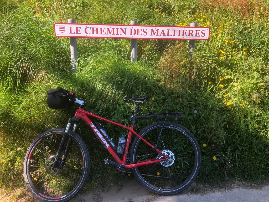
I have started this exploration with Le Chemin des Maltières, on which our home stands. The suffix “ières” is fairly frequent in Jersey and usually means a farm. Les Maltières comes from the family and fief name, Malet.
We live close to the Manoir de Prés where we plan to celebrate our daughter Catherine’s wedding to David Dixon in September. The Manoir was known as Maltières in the 17th Century and is still a working farm. It is now known appropriately as the Manoir de Prés. The name refers to the location, Prés meaning meadow, which happily remains a meadow landscape.
Our house name when we bought it 35 years ago was already “La Cache”. The house is post war. The name we assumed came from the French, meaning hidden place. We liked the name and kept it.
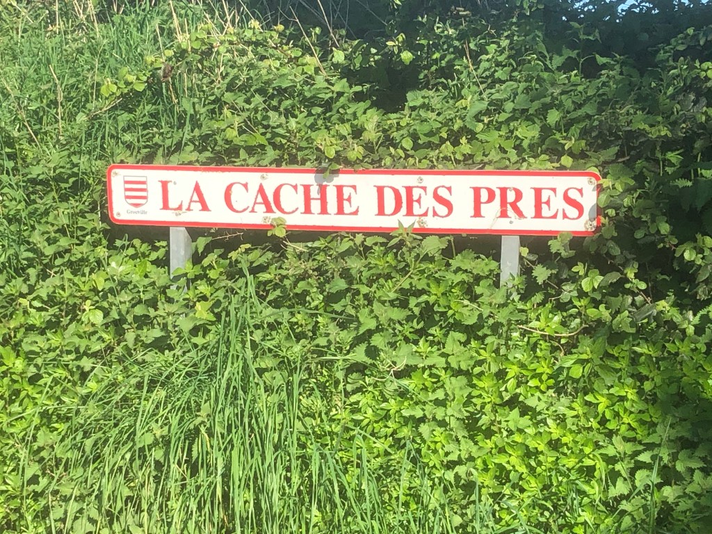
Confusingly (sort of), turning off Chemin des Maltières, (so close to our house), is La Cache des Près. Here La Cache has quite a different meaning, being similar to La Chasse, the hunt. It originally meant open ground where the seigneur hunted rabbits, but came to mean a droveway or avenue leading off a road to a house or manoir.
So the landscape here is reflected in the road names. Chemin des Maltières passes above Maltières, the farm of the Malet fief, from where another road, now La Cache des Près was formerly the avenue leading to the Manoir now known as Le Manoir de Prés.

Leading from Le Chemin des Maltières to Grouville Church, where Catherine and David plan to marry in September, is first La Rue du Moulin de Bas, then the lower part of Le Catillon and finally La Rue de Grouville.
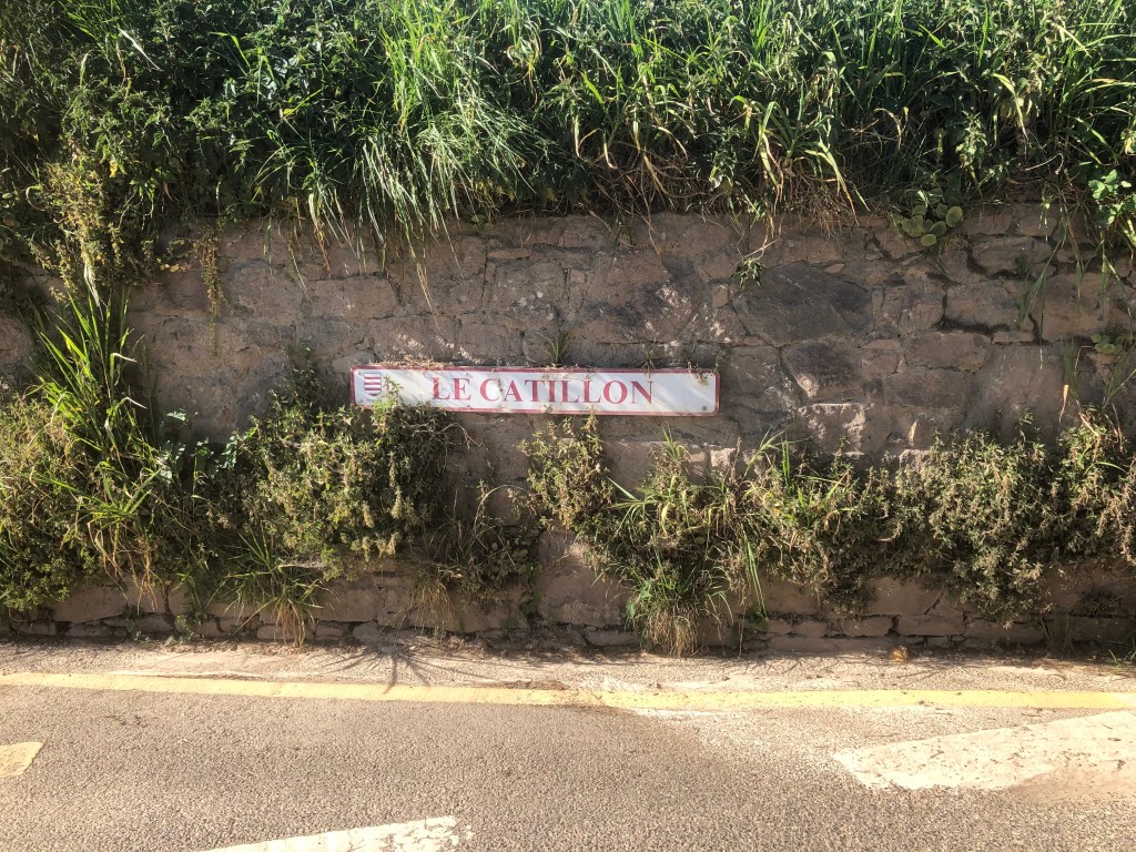
The road, Le Catillon continues uphill. Catillon means something like the small fort. The name has become known far beyond Grouville. In 1957 Le Catillon Hoard was discovered there, comprising some 2,500 late Iron Age coins. Local metal detectorists and characters, Richard Miles and Reg Mead, believed there could be other deposits nearby and in 2012 unearthed what has become known as Le Catillon II Hoard, comprising 60,000 late Iron Age coins together with jewellery and Gold Torques making it the biggest such hoard in Europe.
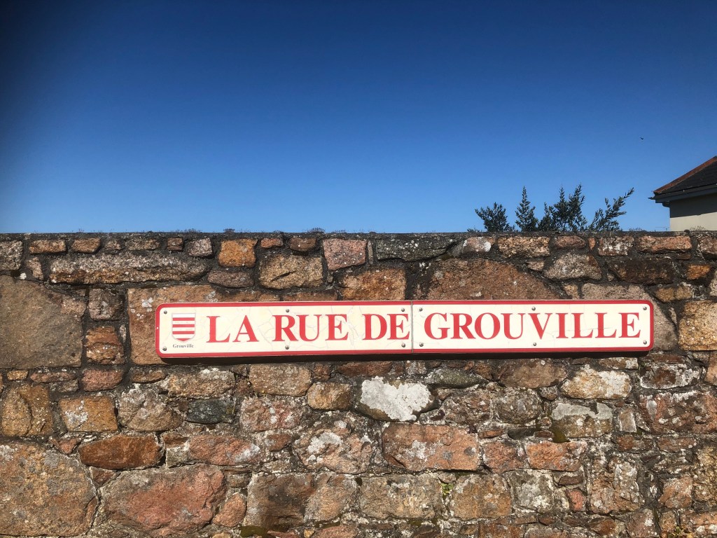
La Rue de Grouville, leading to the church, turns out to be more interesting than at first sight might appear. It was known as La Rue de Grouville in the 16th and 17th Centuries. At that time approximately, Jersey’s parishes were split between their subdivisions, known as vingtaines, including as one of Grouville’s four vingtaines, La Vingtaine de la Rue. Out of 51 vingtaines in the Island, I found there are 37 in which there are roads with the same names as the vingtaine. The natural assumption is the vingtaine name came first, so such roads were called after the vingtaine. However in this case (and possibly two others) it seems that the vingtaine has been called after the road.
To be continued….
